

Teevnabinnia [Ben Leiva]
Good walks are even better shared.
Overview
Teevnabinnia [Ben Leiva]
Teevnabinnia, also known as Ben Leiva, stands tall at 772 meters in the Argyll and Bute region of the Scottish Highlands. This Corbett offers a delightful hiking experience for both novice and seasoned adventurers.
Geology
The mountain is primarily composed of sandstone and granite. Its geology showcases the natural processes that have shaped this beautiful landscape. If you look closely, you might spot some fascinating rock formations that tell tales of ancient geological events, like that time the earth was just a sprightly teenager! Glacial erosion has sculpted the mountain's rugged character.
Routes
One of the most popular routes is the West Highland Way Approach, which spans approximately 12.0 km. This moderate trek provides a beautiful entry into the region, making it perfect for those looking to soak in nature without breaking too much of a sweat.
Summit Features
Upon reaching the summit, you'll be greeted by a substantial stone cairn and a trig point—ideal for that photo to prove to your friends that you did indeed ascend a mountain! The views from the top are simply breathtaking, demonstrating just how beautiful the Highlands can be.
Terrain
Expect a mix of rocky paths interspersed with grassy moorland, though take care as it can turn a bit boggy during the wetter months. A good pair of boots is your best friend here!
Views
From the summit, scenery stretches as far as the eye can see—behold Loch Awe to the south and the grandeur of the Dalmally hills. The views on a crisp autumn day are something you won't soon forget, with vibrant hues painting the landscape.
Hazards
As with any mountain adventure, precautions are necessary. Weather can be fickle, so prepare for changes that could leave you singing a different tune. Loose rocks and boggy patches are common, so tread carefully and don’t forget about your wildlife friends—though they are usually more interested in keeping their distance!
Access
To get started, you can park at the Dalavich parking lot, a convenient location for accessing the West Highland Way. Public transport options from Oban are available, albeit a bit erratic.
Nearby Facilities
While Dalavich is fairly small with limited amenities, the nearest big town, Oban, offers a treasure trove of cafes and shops. Consider grabbing a bite or a cuppa after your hike—it’s a great way to reflect on your day.
History
The name 'Teevnabinnia' hints at deep-rooted history, tied to ancient Gaelic culture. This mountain has witnessed countless tales woven into the tapestry of Scottish history. Whether it was community gatherings or solitary reflective moments from ancient peoples, there's a profound significance that adds to the charm of this natural wonder.
In conclusion, Teevnabinnia [Ben Leiva] is not just a hike; it's a journey through time and a passage through the stunning beauty of Scotland's wild heart. Don't forget your camera, because this is one for the books!
Last Updated
2023-10-01
Explore routes near Teevnabinnia [Ben Leiva]
Public walks starting within 80 km of this hill. Nearby does not mean a route reaches the summit; check its map and access before setting out.
No public routes are currently listed within 80 km of Teevnabinnia [Ben Leiva] on Walkmates. This does not mean there are no paths here. Explore the map and check local access information before planning a walk.
Route planning notes
These notes describe possible approaches, not verified navigable routes or permission to cross land. Check current paths, local access rules and conditions before setting out.
West Highland Way Approach
A scenic route that begins from the famous West Highland Way, traversing through glens and providing stunning views of the surrounding countryside.
Make a day of it, together
Find someone to share the walk with, or organise a day out along a route you like.
Photo Gallery
View all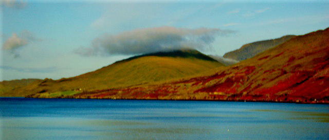 Photo could not load
L8264 : Small Cloud over Tevnabinnia (433) & Slopes of Ben Gorm ( 754)
Joseph Mischyshyn
Hill facts and local notes
Classifications
Elevation
380m
1,247 ft
Prominence
214m
Coordinates
53.6137, -9.7762
L825641
OS Map
37
At the Summit
The summit boasts a large stone cairn that offers a perfect spot for a breather and a panoramic view of the surrounding area, complimented by the presence of a small trig point.
Terrain & Geology
Primarily composed of sandstone and granite, Teevnabinnia displays fascinating geological formations that reveal the area's tumultuous history. Glacial erosion has left distinctive features, making it a marvel for geology enthusiasts.
Views & Scenery
From the summit, hikers can enjoy breathtaking views over the Ardbeg and the surrounding Highlands, with Loch Awe and the distant peaks of the Dalmally hills visible on clear days.
History & Heritage
Name Origin
The name 'Teevnabinnia' derives from 'Tighean na Beinne', translating to 'houses of the hill' in Gaelic, referring perhaps to the ancient settlements of the area.
Historical Significance
Historically significant for its strategic location and natural resources, the area has seen various settlements from prehistoric times to the present, contributing richly to Scottish heritage.
Getting There & Facilities
Check current local access restrictions, parking rules and transport timetables before travelling. These notes do not confirm public access to the summit.
Parking
The nearest parking area is located at the start of the West Highland Way near Dalavich, providing easy access to the trailhead.
Public Transport
Local buses run from Oban to Dalavich, which is the closest access point for hikers. Keep schedules handy as services can be infrequent.
Nearby Facilities
Dalavich has a small shop, but for more extensive facilities, Oban offers cafes, restaurants, and public toilets.
Safety Information
Known Hazards
- Be cautious of the weather, as conditions can change rapidly. Loose rock and boggy areas can present risks, particularly after heavy rains. Always keep an eye out for wildlife which, while lovely, can be unpredictable.
General Safety Tips
- Check weather conditions before setting out
- Carry appropriate clothing and equipment
- Let someone know your planned route
- Take a map, compass, and GPS device
- Carry emergency supplies: food, water, first aid kit, torch
Hills
Some common questions about the hills answered
Are there group walks up Teevnabinnia [Ben Leiva]?
Many walkers use Walkmates to join or organise walks with others. You can check for group walks around Teevnabinnia [Ben Leiva] through the maps
Are there other walkers around Teevnabinnia [Ben Leiva]?
Activity varies by location and time, but Walkmates lets you see whether others have shared walks or shown interest in this area. Find other people through the walking friends search walking friends for Teevnabinnia [Ben Leiva] search or of course create your own walk for Teevnabinnia [Ben Leiva]
Can I organise a walk to Teevnabinnia [Ben Leiva]?
Yes. If there aren’t any walks listed already, you can create a walk and make it available for others to join.
If you're signed up to Walkmates, you can create a walk to Teevnabinnia [Ben Leiva].
How do I find a walk up this hill?
There are often multiple ways to walk this hill, depending on experience and route preference. Walkmates helps you explore walks and routes that others have shared.
Can I suggest a new route up Teevnabinnia [Ben Leiva]?
Yes. You can suggest or create routes to share with others. Walkmates focuses on the social side of walking, so routes are used to help people organise walks and explore areas together, rather than as detailed navigation tools or route libraries.
Other uses really appreciate knowledgeable walkers sharing their routes. Share your favourite route to Teevnabinnia [Ben Leiva] here
The is an error or something incorrect about this hill. How do I let you know?
We always strive to keep the information on Walkmates as accurate as possible. If you find an error, please let us know through the contact form and we'll aim to correct it as quickly as possible
Community Discussion
Comments
Location
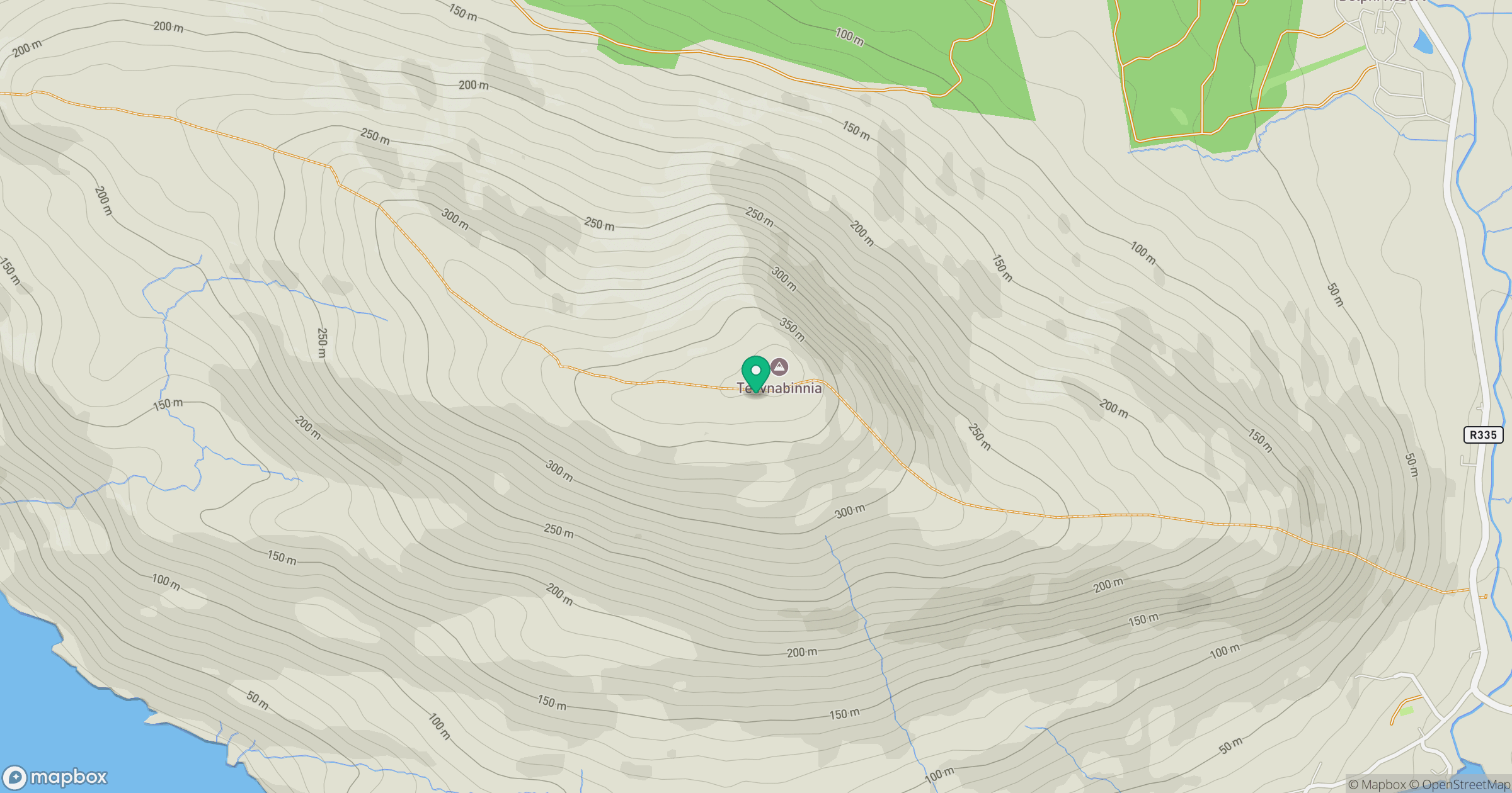
Grid reference: L825641
View on OpenStreetMapOpens a map in a new tab, centred on the hill.
Hills within 30 km
Straight-line distance, not a walking route or confirmation of access.
No comments yet. Be the first.